Monday, March 26, 2018

Sequoia National Monument CA

As we climb up the Panamint Mountains out of Death Valley we are treated to a rare sprinkling of rain as well as jets buzzing low overhead practicing their maneuvers from the nearby Naval Air Weapons Station. We turn south on Hwy 395 and then west onto 9 Mile Canyon Road, which winds its way upward to Kennedy Meadows Campground, located on the southern part of the Pacific Crest Trail (PCT). This campground is often used as a starting off (or ending point) for hikers. Just to confuse everybody, there is another more northern Kennedy Meadows Campground also on the PCT. Both two campgrounds are welcome stops for hikers for mail and provisions.
Joshua Trees and sculptures welcome us to Owens Valley

Almost there for our night's camping


The campground is due to close down in just a few days and we appear to be the only ones here, so we get the pick of any campsite we want. Late that night we spot a car making the rounds. At first, we believe it's some late arrivals, but as the car stays awhile in different spots our imaginations get the best of us making us nervous as to what these people are up to. Soon we realize they are just servicing the toilets. We laugh at ourselves for thinking the worst.
Last daylight on surrounding peaks

Morning at our campsite


As we leave, we stop at the Kennedy Meadows General Store. The manager there is grateful we have stopped to pay our camping fee as it seems he sees many people trying to dodge paying. He's also glad to see just about anybody at all as the season is almost over. He tells us only one south bound hiker was  in the campground besides us (guess were weren't alone after all). He estimates about 2100 PCT hikers have been through here for the 2017 season, which is several times more than the usual 500 per year before the book and movie Wild came out.

We ask him about the common misunderstanding by Easterners that the PCT is easier to hike than the Appalacian Trail. He laughs and says he's also heard that one before.  This misconception comes from the fact the AT does have more altitude gain overall than the PCT, because hikers are constantly going up and down several hills each day before reaching camp. On the PCT hikers go up and down one high mountain pass each day. What they don't realize is the Sierras are much higher and more rugged than anything on the AT.  Ahhh - mystery solved.

We get back on the road, which is now called Sherman Pass heading west towards home. Sherman Pass runs through both the Sequoia National Forest and Sequoia National Monument. It's a beautiful road without many other vehicles, but also very narrow with sharp curves. We can easily see why it's the least traveled pass over the Sierras.
View at the top of Sherman Pass


Despite being named after the mighty Sequoia Tree, we see precious few of them from the road. Mostly we see Ponderosa Pines. Still it's a gorgeous fall day with colorful trees and lovely waterways.
Ponderosa Pines

Sequoia on the right

Mountain stream


Kern River

Granite outcrop

Kern River


Fall colors

Side stream

Almost out of the mountains

As we near the bottom of Sherman Pass, we see evidence of forest fires, some older and one very large and recent burn that destroyed just about everything in its wake. Later we stop at the Porterville Ranger Station. Turns out the ranger at the information desk originally comes from the Hopi Mesas (small world). We tell him that we have just come from there and ask him how he ended up in Porterville. He responds that the traditional life of the Hopis is difficult often involving an hours long hike each couple of days just to haul water.  Although he misses his family, he is happy to be living in a home with modern conveniences. He tells us the recent burn we drove through happened last year when a drunk drove a car over the embankment late at night after the bars closed. The car burst into flames immediately killing the driver and sparking the forest fire.  It happened late in the dry season with high down-slopping winds whipping the fire up into a blasting inferno. It was a beast to put out and was only eventually tamed by the advent of the rainy season.

We also ask him about not seeing many sequoia trees.  He laughs and says they are mostly only in several well known groves. In fact, he shows us a map of the area which has every sequoia tree marked. Of course we buy it immediately after thanking him for so freely sharing his knowledge.
The remains of a nasty Kern fire 

Older burn at peaks

In many places, all that's left is rocks and ash


It's only a few hours drive to home and we are soon driving over the golden hills signaling the beginnings of the Coastal Range.


Saturday, March 24, 2018

Revisiting Death Valley CA

In the morning we decide again to use the path less taken by entering Death Valley via the south. From Tecopa Hot Springs, we drive north on Hwy 127 towards Death Valley National Park. At Shonshone, we turn west on 178 to enter the park from the little used south entrance. In fact, this entrance used so infrequently, there's not even a booth with rangers collecting entrance fees. Instead there's an electronic ATM like stand urging you to pay your entrance fees. Since we have our Geezer Passes giving us free access, we sail right on by wondering if we'll ever be questioned.
Hummm - were do we go next?

Northward on Hwy 127


We love this entrance. As we drive along, panoramic views of Death Valley open up around almost every turn - all without having to compete with hoards of visitors. In fact, there's hardly any cars at all.
Around one turn

and then another


Descending into Death Valley


The first attraction we come to is Badwater Basin. Although there's a number of cars already parked in the lot, we have no trouble finding a good place for the camper.  Ah the joys of traveling off season. We meet a group of good natured Dutch students and have fun swapping stories and photos. At 282 feet below sea level, Badwater Basin was thought to the the lowest lake on earth until the discovery of Laguna del Carbon in Argentina at 344 feet below sea level. The water is mostly fed by an underground spring, but the spring is so briny that the water is completely undrinkable.  Occasionally, a rare rain storm will fill the basin creating a shallow lake. However, soon the hot dry air of the desert causes the water to evaporate leaving behind even more salt and minerals.


Water pool at Badwater Basin


We then continue north until the turn off for Artist's Palette, one of my favorite stops in the park.


Again we see several foreign visitors in the parking lot.  A couple from Italy drive in about the same time. They are impeccably dressed in expensive clothes and are driving either a BMW or Mercedes car rental. They look at us strangely in our funny looking camper.  I guess you don't see many Alaskan campers in Italy.

The wide array of colorful minerals in this area never ceases to amaze me.  Even though we are here on a cloudy day and the colors are muted, they still live up to their name.
Colorful Juicy Van rental

Preparing to take photos

How Artist's Palette gets it's name


Pano of Artist's Palette


It's not only the colorful minerals that draw us back to here, but also the twisting and turning rollercoaster of a one lane road that leads back to the main road. Larger vans and buses aren't allowed on this road because of the narrow roadway and sharp turns, but I'll bet a few have tried and created a major mess in getting it out of these narrow passage ways.


Almost back to the main road


After an unremarkable lunch at the Date Grove in Furnace Creek, we take Hwy 190 towards the Western entrance through Panamint Springs, where we stop for the most expensive fuel in the park at $5 a gallon for diesel. Ouch! Yes Peter, we should have opted for a gas station in Owens Valley.

Pumping pricey fuel 

Exiting Death Valley 


Saturday, March 17, 2018

Mojave National Preserve CA

From Kingman AZ it's a short drive to crossing the Colorado River back into California. Fortunately, California has finally gotten around to improving the roadway, but apparently the state is slower to maintain the Rest Areas (sigh). California's not a great state to be driving long distances for people with a tiny bladder.
Bridge over the Colorado coming up

Why am I not surprised?


The more we travel, the more we search the maps for places we've never been.  The Mojave National Preserve fits the bill. Just after Fenner CA at exit #100 we turn northward onto a gravel road into the Preserve.  After a few miles, our Google Maps navigation has completely lost sight of where we are. Ahhh - no cell bars traveling; free at last from the Net!
Hey here's a big spot on the map we haven't been

We are now officially off the gird 


Up to the Visitors' Center and Hole in the Wall Campground, the gravel road is well graded and easy to drive. Of course we stop at the Visitors' Center.  At first, there doesn't appear to be anyone around and there's no indication whether it's open or closed, so I knock on the door and it's opened by a lady Ranger.  She is taking a lunch break with her husband and two grade school daughters.  We back off saying we don't want to take up her time during her break.  She says no, no please come in as not many visitors stop in she's glad to see us.

Her office area is chock full of interesting objects from the surrounding desert, including fossils and some very large horns from the local Bighorn rams. I would love to have one of those.  She says they find the discarded horns out on hiking trails through the hills and canyons.  She is free with sharing her wealth of information about the area and points out interesting hiking trails and things to see.  She laughs that with Death Valley so close it draws all the crowds with only a small fraction find their way to the Preserve.
Mojave National Preserve Hole in the Wall Visitors' Center


After leaving the Visitors' Center the road becomes dirt with sand and sketchier, but both Peter and the camper handle it well. We pass the Gold Valley Ranch which must be one of the few sections of private land grandfathered in when the Preserve was created. With the arid terrain and sparse vegetation, these ranchers must need lots of land to just feed a few cattle. Still you got to admire these hardly souls for sticking to a way of life that can't be easy.
Interesting rock formations

Gold Valley Ranch

Cattle at the watering hole


Further down the road, we come to the Mid Hills Campground which is by far the nicer of the two on the Preserve. After only seeing a few vehicles of any kind for some time on the road, we are surprised to find a handful of campers already here. They mostly smile and greet us with a wave. Friendly folks out here in the middle of no where. We choose a nice site and pull in for lunch.
Trusty camper at lunch site

Nice place to stop

I love the stark beauty of the desert

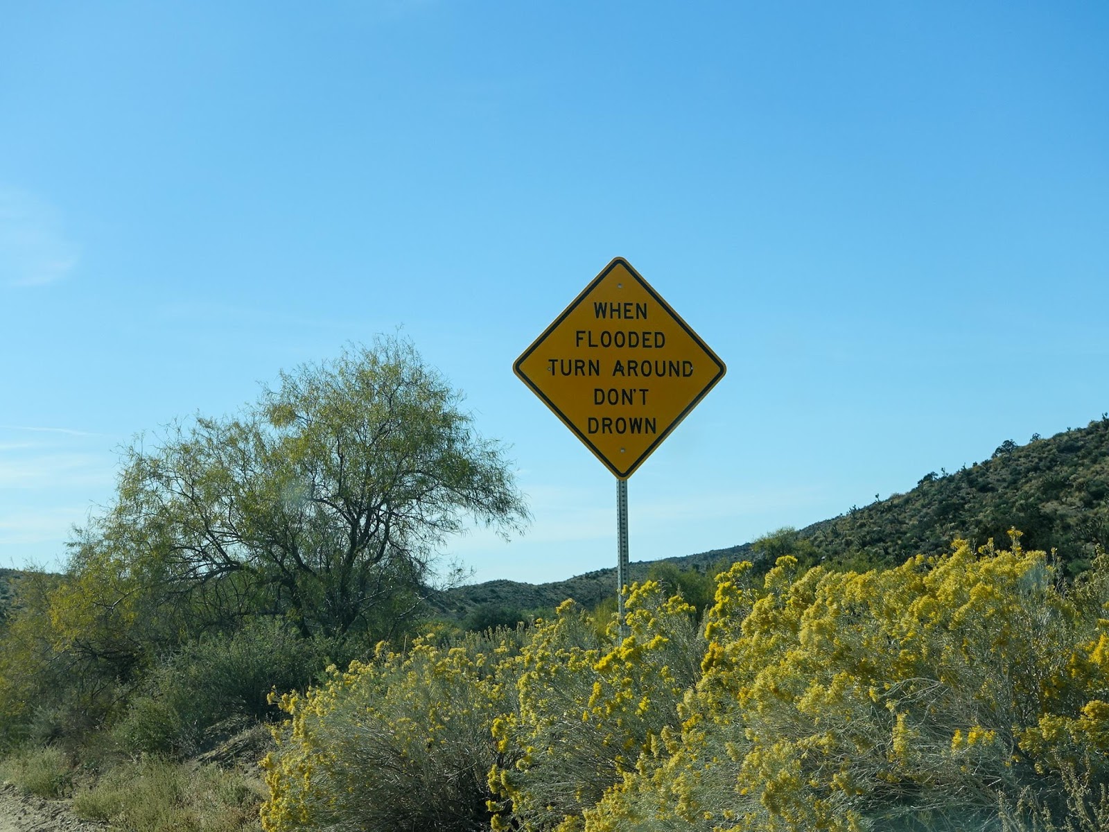
The road now becomes a dry stream bed.  With all the flowers in bloom it looks like they got good monsoonal rains. However, we are both glad the stream beds are dry. They are probably pretty nasty in flood rendering the road impassable at best and deadly at worst.
Flowers along stream bed/road

Quick - grab this rock for our garden

Wise advise

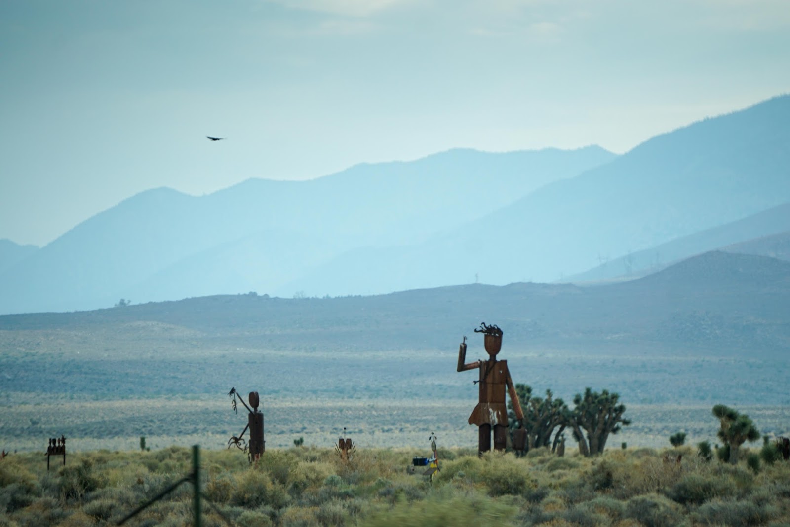
As we climb in altitude, we start seeing Joshua Trees, then lots of Joshua Trees. In fact, they are very healthy looking Joshua Trees; much healthier than the ones we've seen in Joshua Tree National Park or just about anywhere else.


Sooner than we'd like, we find ourselves at a gas station at an unknown exit on I-15 just east of Baker. Sigh - we're back in civilization and headed for Tecopa Hot Springs for the night.
Gas station on I-15

Giant thermometer at Baker

Desert just south of Tecopa

When we get to Tecopa Hot Springs, we discover it is now under a new owner since the last time we were here. He's making a good attempt at bringing the place it up to at least minimum building code. Don't worry, it's still very much a funky place with an interesting supply of desert rats camped out.
Home for the night

View from edge of campground


About Me

My photo
Retired and enjoying life.