After returning from our epic (for us at least) journey driving up to Alaska and back, family and friends asked us lots of questions. To wrap up this trip, here are the mostly commonly asked and our attempt at answering them.
So where all did we actually go?
Actually, this is one of the easier ones to ask. Although the explanation can be rather long winded for such a long trip. Overall, we travelled just short of 10,000 miles. Here's where we camped and the ferry ports we visited:
View Alaska2012 in a larger map
What were the highlights of your trip?
This is a hard question to answer as there were so many highlights, but here are three towards the top.
How long were you gone?
We were gone a total of 10 weeks, which was a good amount of time to allow shorter driving days (3-5 hours) with plenty of time for sightseeing, hiking, and layover days. We met people who were doing a similar drive in a month (or less), but they complained of long driving days without much time to enjoy the sights. We left on July 2 and returned on September 9 so we could take advantage of the best weather and long summer days ("land of the midnight sun" is not just a saying).
How was the weather?
Mostly, we were pleasantly surprised at how good the weather was. The hottest weather was in Canada's
Okanagan Valley with daytime temps easily soaring into the triple digits (needless to say we headed for the hills -
Canadian Rockies that is). The coldest temperatures was frost in the morning in
Dawson City, Yukon, but the days there easily warmed up once the sun was up. The coldest we felt was in
Seward, Alaska when the winds blew down the fiord from the glaciers. The average temperatures we encountered were in the 50-60's F in the days and 40's at night. Here's a general breakdown of the weather we encountered (no snow):
How were the roads?
 |
| Alaskan Hwy in southern Yukon |
In short, surprisingly good, especially considering most of them are built over permafrost. About 95% of the roads have good smooth surfaces without many potholes or buckles. Most of the roads have wide cleared sections on either side with many wildflowers in bloom and occasional wildlife grazing.
However, beware of sections where you have to keep a sharp eye out for frost buckles and warning signs for sections of gravel (the Milepost was pretty good at warning you where to expect these sections). Being summer, road construction crews were out in full force. In fact, we were surprised at how much of the road in
Denali Park was under construction (especially at night close to our campground).
Although most of the main roads are good, the lesser traveled side and/or
seasonal roads can be downright treacherous, especially in bad weather. Good sense and caution does need to prevail.
Did you encounter anything unexpected?
It was one of those trips where we learned to "expect the unexpected." Almost every turn had something new and unexpected. Here are three of the most unanticipated pleasures we encountered:
|
|
 |
| Wildflowers in abundance |
|
Did you bring your dogs?
 |
| Grizzly grazing a mile from camp |
NO - we did not. Our terriers love to chase all kinds of critters, so we decided to leave them at home with a close friend. It was the right decision. Many people along the way told us dogs and bears are a bad combo. Often a dog, such as ours, will start barking and otherwise annoying a bear who will turn and charge the dog. The dog runs away and hides behind its master (who can't run as fast as the bear or the dog).
Did we see any wildlife?
YES - we saw all kinds of wildlife. Here are just a few of the critters we captured on camera, but there were many more either not shown or we simply couldn't act fast enough to snap a shot of. For instance, while driving around Homer AK, we saw what we thought were crane lawn statues... but they moved and proved to be three
Sandhill Cranes. Who knew that they like to summer around Home? We certainly didn't.
What were your most helpful information resources?
Since Internet connectivity is problematic (more on this subject below), our best resources were paper publications (remember that medium?). For general driving and what to expect along the road, the
Milepost is a must have. Although it may not make complete sense to you until you are actually on the road, it does provide excellent planning materials. For finding campsites, the Alaska Camping book is another must have as it contains more objective and comprehensive information than the Milepost (which mostly lists establishments paying to be in the book). Once in Canada do stop at the first Information Center you come to in both British Columbia (for Provincial Parks) and the Yukon (for Government Campgrounds) to pick up their respective campgrounds booklets as well as any other information that looks useful.
Tips for travelling in Canada
As much planning as we did for this trip, one place we could have improved was preparing for traveling through Canada. With a little more fore thought, our first few days in British Columbia would have been less confusing; however, we quickly made the necessary adjustments.
- Money - Canada is more expensive than the US... the joke that BC really stands for "Bring Cash" and not British Columbia isn't far from the truth. Many businesses close to the US border will glad take your US dollars. Credit and ATM cards will work for most grocery, liquor, and fuel stops. Do check your bank or credit union before you leave to see what percentage they'll charge you for making purchases in Canada. We learned our credit union charges 1/2 the rate that our BofA card does. Do carry Canadian cash for those businesses that don't or can't take plastic (especially for fuel). The farther you travel the more you'll need Canadian dollars and especially coins for vending and laundry machines (be sure and hang on to your Loonies and Toonies).
 |
Most useful Canadian coin
the $1 "Loonie" |
|
|
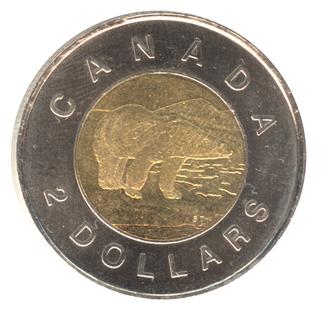 |
Second most useful coin
the $2 "Toonie" |
|
- thinKMetric - Yup Canada is on the metric system and we're not, so you'll need to get used to seeing distance markers and temperature readings in metric. After awhile it'll become second nature, but while making the transition it's useful to have conversions handy either as a table on paper (kilometers/miles, liters/gallons, temperature), or as a smart phone app (don't worry there's lots of free ones).
- Border crossings - gone are the days all you needed was your driver's license. Now you'll need a passport, so carry one with you. Also, you'll need to show proof of vehicle insurance to cover you while in Canada (check with your current insurance carrier). There are limits to how much alcohol (personal use only) you can bring across so don't go overboard. Although we were told there were restrictions on some sorts of fresh produce, we weren't asked about any (going into Canada). If you are carrying some kind of gun or weapon you will have to declare it or suffer dire consequences. The Mounties were fine with our carrying bear spray. To avoid long waits, do try to cross in the middle of the week on an off hour (early or mid morning) and don't try to joke with the Mounties, they have about as much a sense of humor as TSA inspectors.
- Fuel up when you can - the farther you get from the border, the fewer gas stations you'll see (and the more expensive they are). If you're running around 1/2 tank and you see an open station, stop and top off - you'll be glad you did.
- Don't grumble - Canadians are generally very polite people and will try to please you as best they can. The simple fact is goods cost more in Canada and Alaska because of the long distances covered to get there. Also, summers are short and it's often the only time most tourist businesses have to make a living to last them the whole year. Just be happy you can get what you need
| |
Connectivity
To be able to use your cell phone in Canada, check with your carrier before crossing into Canada or face paying an arm and a leg for extra international roaming charges. Verizon charged us around $20/month to cover phone calls and text messages. Data became too complicated and expensive, so we simply turned off our data connections while in Canada.
Yup - I had to give up using the navigation system on my Droid and went back to using paper maps and guidebooks {sigh - it was a bit of a transition back to paper}. BTW - we discovered text messaging was the most viable way of communicating as often messages would get through when nothing else could. Still, you'll find days will go by with little to NO connectivity at all with the outside world. Gotta love "no bars" traveling.

As far at Internet connectivity goes - don't expect it and do be grateful when you do get a decent connection. Many RV parks will advertise "Free WiFi"; however, what they won't tell you is it doesn't work well at best or not at all most of the time. Our friend and house/critter sitter David once got a cell call to us while we were traveling through the Yukon wanting to know if we had received his email. We told him we were lucky to find a open gas station with diesel - the Internet was a "forget it." He replied why didn't we simply stop at the nearest MacDonalds? We said the last and probably only one we saw was in Whitehorse over 100 miles away and even there connectivity wasn't likely.
Don't waste your money on a Verizon Jetpack. We bought one which worked perfectly in the store and only once afterwards, no matter how much time we spent on the phone with Tech Support. To add insult to injury, Verizon wouldn't refund our money after we got back home.
So the morale to the story is if you luck into a place you can get a good WiFi connection, use it as much as you can as you may not find another for some time.
Ferries
We decided to take the ferries back from Haines, Alaska to Port Angeles. It was expensive but it not only saved us over 2000 miles of driving, but we got to see parts of the Alaska and BC coastline that we would have missed otherwise. We met several people who had elected to take the ferries up and drive back, which we'll probably do for a later trip.
If you want to take a ferry for part of a trip, you'll need to plan ahead. Tickets and cabins sell out especially on popular routes - like the Alaska Ferry from Bellingham WA to Alaska in the early summer and/or return the same route late summer. The most expensive part of the tickets were paying for our vehicle (charged by the length). In fact, the RV cost more than each of our personal tickets and cabins combined.
In our case, we traveled a less poplar route and didn't have any problems getting the tickets we needed. We booked our
Alaska Ferry tickets from Haines to
Prince Rupert BC about a month before departing. We booked our
BC Ferry from Prince Rupert to Port Hardy only two weeks before departure and our Victoria BC to Port Angeles WA
Black Ball Ferry the day before.
Would we use the ferries again? Yup - in a heart beat. We had a great time on the ferries both seeing the scenery and meeting all kinds of people. Besides we got to convert the last of our Canadian dollars into a nice bottle of Grey Goose in the Black Ball Ferry's Duty Free shop before landing in Port Angeles.
The bottom line - How much did it cost?
Although people are often hesitant to ask, many are interested in knowing how much such a trip costs. As a rule of thumb, traveling the way we did cost around $1/mile for the basic expenses which include:
 |
| Basic expenses for Alaska Trip |
We traveled in a comfortably using a combo of government campsites ($10-$25/night) for about 2 or 3 nights and then a commercial RV Park a night or two for showers and laundry ($25-$60/night). Some people save money by using only free (boondocks or parking lots) campsites. We wanted to take full advantage of the beautiful scenery so we were willing to pay more. Also, money could have been saved on both groceries and the ferries. However, there's little to be saved on fuel costs. If you want to get there, you'll simply have to pay the going rates. The IQ gets an average of 16-18 mpg on diesel. If your vehicle gets more or less so will your fuel costs be different accordingly. We did find we could save some money on fuel by buying at stations:
- within 10-20 miles of town as they tended to be cheaper than those in town
- on a tribal reservation (lower fuel tax and surcharges)
- at Fred Meyer (10 cents per gallon off per $100 purchases/month)
- at Costco
Sooo, what did we actually spend? Without going into the actual dollars and cents, here's how our overall expenses turned out:
 |
| Full expenses for Alaska Trip |
Other than ferry tickets, the single most expensive item we paid for was $450 to Ray Atkins to take us
flightseeing over Denali. Expensive? Yes, but for an experience that left us feeling we could die and still think we had lived a full life, the cost was well worth it.
Of course we could have spent much more on the trip. We would have loved to go on a $600/each flightseeing trip out of Homer to see grizzlies catching Salmon, but the total would have paid for our BC Ferry ride, so we passed. Still we had a great time and didn't feel like we had deprived ourselves of much.
Would we go again?
YES - most definitely. In fact, we're already talking about going back for a trip another year later in the summer and into the fall... but not as long. We've discovered over two months is a bit too long for us. We admire full time RVer's, but we simply get too homesick. So 4-6 works best for us. In the end we've discovered the true meaning of our license plates -
not Gone for Good
but rather Gone for a Good Time.


